
44: The Pocket Atlas That Still Makes You Whisper “Wow”
Google Earth
Get it on Playstore Get it on the App Store
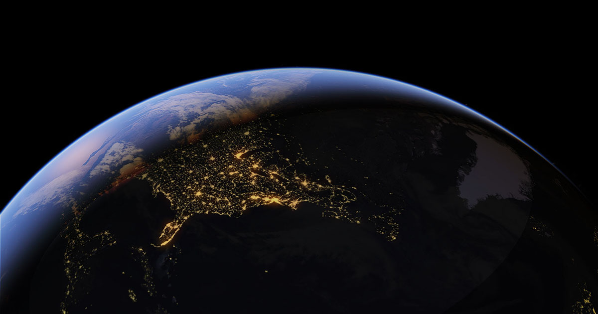
More than twenty years after its desktop debut, Google Earth remains the gold standard for digital exploration—and the Android version is no mere after-thought. It crams a planetary-scale atlas, a 3-D globe, a time-machine, and a private flight simulator into a single icon that weighs less than a Spotify playlist. Whether you’re hunting for a first-world childhood home, scouting a remote trailhead, or killing an hour “flying” over the Andes, Earth delivers the same spine-tingling zoom that once crashed coffee-shop Wi-Fi on bulky PCs.
First Orbit
Install is a 10 MB stub; the globe itself streams on demand. On first open you’re dropped into a crisp overview of your current location at 2 km altitude, gyro-stabilised as you pan. A discreet “Explore” button in the lower left cycles through editorial highlights: aurora over Iceland, glacial lagoons, neon megacities. Tap once and the camera roller-coasters across 3-D topography while place-cards pop up like postcards in mid-air.
Core Navigation
- Two-finger drag = pan; twist = bearing; pinch = altitude (1 cm can drop you from Low-Earth Orbit to rooftop).
- Tilt icon switches to first-person “eye level” view—perfect for virtual hikes.
- Search bar accepts lat/long, postcodes, or plain English; results animate smoothly instead of jumping.
- Layers button overlays Roads, Borders, 3-D Buildings, Weather, Wildfires, Earthquakes, even CO₂ data.
- “Feeling lucky” dice throws you to a random curated gem—great for geography students or dinner-table trivia.
3-D Cities & Photoreal Tiles
More than 2,500 urban cores now render in full photogrammetry. Skyscrapers cast accurate shadows, bridges show expansion joints, even trees are volumetric. On a Snapdragon 8 Gen 2 the frame-rate holds 60 fps at 1080p; on mid-range chips it gracefully drops LoD but keeps navigation smooth. Offline areas cache 3-D meshes too—handy for in-flight armchair tourism.
Street-View Integration
Blue lines appear on roads; tap and you’re inside the familiar 360° bubble. A new “split view” keeps the 3-D globe in the upper pane while Street View occupies the lower—useful for orientation or scouting trailheads. Historical imagery (where available) lets you scrub a time-line back to 2007, watching neighbourhoods sprout or forests shrink.
Pro Tools in Your Palm
- Measure: drop two pins and read distance, area, perimeter—surveyor-grade accuracy for hikers and real-estate spotters.
- Elevation profile: trace a bike route and see grade percentages before you sweat them.
- KML/KMZ import: load custom layers (GPS tracks, drone orthomosaics, NGO deforestation maps).
- Record tour: capture camera movements plus voice-over, export as MP4 for presentations.
- Dark mode and true-night sky map with constellation labels—planetarium mode activated by tilting the phone skyward.
Data & Battery Footprint
An hour of streaming 3-D cities at 1080p consumed 380 MB on Wi-Fi and 9 % battery on a 5,000 mAh phone. Offline “custom areas” cap at 2 GB each (about the size of Switzerland at photoreal quality). Caches auto-purge oldest tiles first; you decide the ceiling.
Privacy Posture
Google signs in only if you opt in (Bookmarks, My Maps sync). Searches and tiles are tied to an ephemeral device ID; no personal account is required for basic use. Incognito mode (long-press profile avatar) pauses history and cookies—useful for sensitive site visits.
Accessibility & Education
Voice search works in 40+ languages. Audio captions describe landmarks for low-vision users. “Voyager” stories—interactive lessons on climate, migration, indigenous languages—are packaged like Netflix episodes and updated quarterly. Teachers can cast tours to Chromecast without leaving the app.
Weak Spots
- Offline areas max out at 2 GB each; large countries need multiple tiles.
- No native night-vision or thermal layers (still daylight visible spectrum).
- Frame-rate can chug on Mali-G52 class GPUs when photoreal cities are stacked with weather overlays.
- Historical imagery is patchy outside North America/Western Europe.
- No direct export of 3-D models for CAD or Blender (Google Earth Pro desktop required).
Pros:
- Planet-wide 3-D globe with photoreal cities and volumetric terrain.
- Street View, historical imagery, weather, wildfire, and earthquake layers baked in.
- Measure tool, elevation profiles, KML import, and screen-record tours.
- Smooth 60 fps navigation on current hardware; graceful fall-back on older chips.
- Works offline (cached tiles), incognito mode, no sign-in required.
- Educational “Voyager” stories and accessibility audio captions.
Cons:
- 2 GB offline tile limit; big countries require multiple downloads.
- No night-vision/thermal imagery; still daylight RGB focused.
- Performance drops on mid-range GPUs when all layers are active.
- Historical satellite coverage is sparse in many regions.
- 3-D model export locked to desktop Earth Pro.
Who Should Keep It
- Travellers pre-scouting hotels, trails, or urban layouts in 3-D.
- Teachers building geography, history, or environmental-science lessons.
- Real-estate shoppers measuring lots and checking sun angles.
- Armchair explorers who still get goose-bumps from a simple zoom-to-rooftop.
Who Can Skip
- Users who need offline maps larger than 2 GB or true topographic trail apps.
- Pilots or surveyors requiring thermal, radar, or night-vision overlays.
- Phones with 3 GB RAM or older Mali GPUs—experience will be slideshow, not smooth-scrolling magic.
Final Orbit
Google Earth remains the closest thing to a holodeck you can carry in a jacket. It turns commutes into intercontinental flights and coffee-shop waits into geology field trips. Offline limits and occasional performance hiccups aside, the Android app is a pocket atlas, measuring tape, time-machine, and private jet rolled into one. Tilt, pinch, whisper “wow,” and remember: the whole planet really does fit inside 10 megabytes.